
GARMIN BLUECHART® G2 S CHARTS
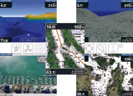
Garmin BlueChart G2 S marine basic 2D mapping features smooth layering and seamless integration of map graphics for easy panning, scrolling and zooming, this marine charting offers comprehensive IALA navaid symbology and marine services.
Features include shading between depth contours, spot soundings, navaids, port plans, wrecks, obstructions, intertidal zones, fishing charts, restricted areas and more.
Fishing Charts contain detailed bathymetric data to emphasise bottom contours and depth soundings.
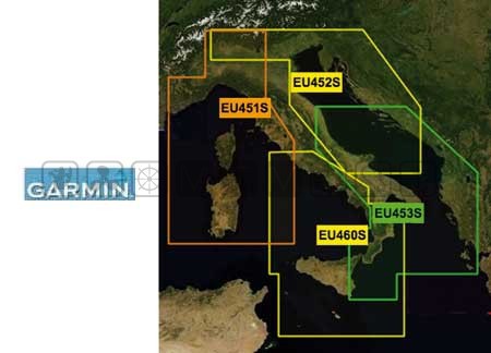
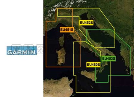
| Šifra | Ref | Copertura | Cijena | U košaricu |
| 5628353 | HXEU452S | Costa Settentrionale Mare Adriatico | 129,00 | |
| 5628351 | HXEU451S | Mar Ligure-Corsica e Sardegna | 129,00 | |
| 5628352 | HXEU460S | Sicilia-Lido di Ostia | 129,00 | |
| 5628354 | HXEU453S | Costa Meridionale Mare Adriatico | 129,00 |